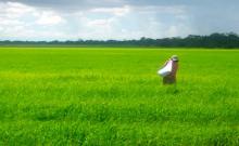
Our Drones can capture highly accurate images of your fields, covering up to hundreds of hectares/acres in a single flight. Without the cost and hassle of manned services. At a far greater resolution than satellite imagery provides, even when there is cloud cover.
By using image-processing software you can then transform these shots into one large ortho -mosaics image. This map is the key to boosting yields, cutting costs, and driving your business forwards. It highlights exactly which areas of crop need closer examination – meaning less time spent scouting, and more time treating the plants that need it.
Agricultural applications would include:
- Monitor crops for ripeness
- Inspect crops for diseases
- Inspect crops for harmful insects
- Inspect crops for nutritional deficiencies

