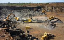
Anyone involved in mining knows that worker safety is of paramount importance. By allowing surveyors to collect accurate spatial data from above, drone or UAV technology can vastly reduce risk by minimising the time these staff spend on site.
Drone-based data collection can also boost productivity; surveying projects that once took days or weeks using traditional surveying techniques are now possible in just a few hours. Plus, thanks to a drone’s ability to collect data from above, there is no downtime required while surveyors move around a pit, as can be the case when using terrestrial surveying instruments. With fewer man-hours required to produce large, accurate data sets, and no need for externally sourced imagery, the result is vastly reduced costs.
Our drone operations could add value to your operations in the following:
i. Short-term planning
- Pit and dump management
- Communication of daily/weekly mining plans
- Haul route surface optimisation
- Storm damage assessment & control
ii. Long-term planning
- Haul road, dump and pit design
- Geotechnical
- Surface stability monitoring
- Joint mapping
- Mapping of steep inaccessible inclines
iii. Drill & blast
- Up-to-date surfaces for optimised blast designs
- Pre- and post-blast data
- Identification of misfires & wall damage
iv. Geology
- Stock pile management
- Grade control & exploration planning
v. Hydrology
- Drainage and water management
- Watershed, drainage basin & water flow mapping
- Tailings dam management
vi. Construction
- Feasibility studies
- Leach pad, dam wall & platform construction quality control
- Progress monitoring & reporting
vii. Heritage & environmental management
- Reporting
- Erosion detection
- Vegetation change tracking
- Inundation (flood) tracking
- Surrounding community mapping
viii. Legal
- Property rights definition
- Change detection
- Security
- Incident evidence capture
- Corridor & boundary surveillance

